|
|
|
|
 |
 |
 > The Red Planet > From Water to Life? > Mars in 3D dimarts, 1 de desembre de 2009
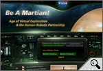
Do you want to be an astronomer and help NASA (the National Aeronautics and Space Administration) to map the planet Mars? Now you can, whilst having fun, through the Be A Martian website, launched a few days ago by NASA and Microsoft.
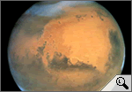
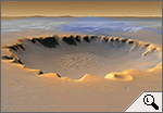
The first high-resolution photographs of Mars were taken during the 1960s. Since then, so many have been taken that NASA scientists are unable to cope. Therefore, the Be A Martian website aims to encourage Internet users to organise this immense volume of information. In essence, the idea is that users perform two different tasks: classify images and count craters, with points being awarded for both tasks. There are a great number of craters on Mars and counting them will help scientists establish the age of different regions of the planet. Be A Martian also allows users to ask questions and obtain answers about different aspects of Mars. All users need to do to ask a question is to register as a Martian Citizen (which is free). The Red PlanetBy visiting Be A Martian you can learn a lot about the Red Planet, so-called because of the reddish colour of its surface (due to the presence of iron oxide). Mars is the fourth-closest planet to the Sun and the second-closest to Earth, after Venus. The surface of Mars contains craters and volcanoes and is scored with enormous valleys. Mars is home to Olympus Mons, which is the highest volcano in the whole Solar System and three times higher than Everest, the highest point on Earth.
From Water to Life?Like Earth, Mars has polar caps, which are much colder than those on Earth and contain water ice. The images taken by exploration missions show the presence of winding channels, which adds weight to the theory that there used to be large quantities of liquid water on the surface of Mars. Did the presence of water in its liquid state lead to the appearance of life? That is the big question that future missions, like NASA's Mars Science Laboratory in 2011, will be trying to answer.
Mars in 3DApart from Be A Martian, Internet users can also explore Mars using Google Earth, a free downloadable program from Google. Amongst other things, Google Earth offers three-dimensional images of the Red Planet, allowing users to zoom in on the most famous places on Mars and to pay an interactive visit. Google Earth also offers users the chance to explore the surface of the Earth, the oceans and also the Moon.
|
Investiga

> Missions a Mart: presents, passades i futures.

> El Planeta Vermell: síntesi.

> Comparació entre la Terra i Mart.
I també...
- Que som sols, a l'Univers?
- Mart a Google Earth: vídeo.
- Atles de Mart.
- Vida marciana?
Portada |
Europa Press |
El Punt |
La premsa |
Especials |
Diari de l'escola |
LesFinances.info |
Editorials |
Mail obert |
Els blocs |
Lletres
Tecnologia i ciència | Solidaritat | Cap de 7mana | Campus | El 9 | Presència | Fòrums | Enquestes | Xat | Correu
Traductor | Edicions en Pdf | Wap-pda | Biblioteca | Lletra més grossa
Tecnologia i ciència | Solidaritat | Cap de 7mana | Campus | El 9 | Presència | Fòrums | Enquestes | Xat | Correu
Traductor | Edicions en Pdf | Wap-pda | Biblioteca | Lletra més grossa
| Què és VilaWeb? Publicitat Mapa web Contacte | Una web de Partal, Maresma i Associats, S.L. |


