|
|
|
|
 |
 |
 > Lots of Possibilities to Explore the Ocean > The Importance of the Ocean, the Great Unknown > Planet Mars in 3D dimarts, 17 de febrer de 2009
Google has just launched a new version of Google Earth, a digital program that allows users to explore Earth by means of maps, three-dimensional images and satellite photographs. Whereas until now Google Earth only covered the planet's land area, the new version covers the whole planet, including oceans.
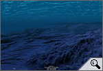
In fact, the 'Ocean' application is the main new feature of version 5.0 of Google Earth, which can be downloaded free in some 40 languages, including Catalan. After downloading Google Earth, users can explore the seabed, including the mid-oceanic ridge, an immense underwater mountain range tens of thousands of kilometres long and hundreds of kilometres wide. The exploration of the oceans in three-dimensional images is enriched with plenty of additional information from organisations that contributed to the new Google Earth: National Geographic Society, BBC, Cousteau Society, International Union for Conservation of Nature, etc. Conservation organisations hope this new virtual tool will raise awareness about the dangers threatening the marine environment and, in particular, the species that inhabit it.
Lots of Possibilities to Explore the OceanThe 'Ocean' application offers lots of possibilities such as visualising photos and videos about different aspects of the seabed, scuba diving around submarine volcanoes, finding out about the most famous shipwrecks in history, following different kinds of animals, such as whales, becoming aware of the serious consequences of overfishing, etc. The new application also offers users the opportunity to contribute photos and videos of their favourite diving and surfing locations.
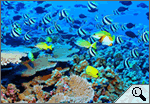
The Importance of the Ocean, the Great UnknownThe ocean covers 70% of the Earth and contains 80% of all life on the planet, although only 5% of it has been explored. Even though we still know very little about it, the ocean is of paramount importance for our survival. For example, it has 97% of all the water on the planet; it produces more than half the oxygen in the atmosphere; and it absorbs most of the carbon in the atmosphere.
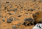
Planet Mars in 3DGoogle Earth does not limit itself to Earth. It also offers three-dimensional images of Mars, the fourth-closest planet to the Sun, after Mercury, Venus and Earth. Amongst other features, users can climb to the top of Olympus Mons, the highest volcano in the entire Solar System, three times higher than Mount Everest, the highest peak on our planet. It is even possible to talk to a Martian called Meliza, who praises the virtues of the so-called Red Planet.
|
Investiga

> Explora l'oceà amb Google Earth (vídeo).

> Balena blava, espècie amenaçada.

> Mart en 3D, a Google Earth.

> Com instal·lar Google Earth en català, si no tens el sistema operatiu en aquesta llengua.
I també...
- Qüestionari sobre oceans.
- Històries de la fragilitat oceànica.
- L'impacte humà en l'oceà.
- Sobre el Planeta Vermell.
Portada |
Europa Press |
El Punt |
La premsa |
Especials |
Diari de l'escola |
LesFinances.info |
Editorials |
Mail obert |
Els blocs |
Lletres
Tecnologia i ciència | Solidaritat | Cap de 7mana | Campus | El 9 | Presència | Fòrums | Enquestes | Xat | Correu
Traductor | Edicions en Pdf | Wap-pda | Biblioteca | Lletra més grossa
Tecnologia i ciència | Solidaritat | Cap de 7mana | Campus | El 9 | Presència | Fòrums | Enquestes | Xat | Correu
Traductor | Edicions en Pdf | Wap-pda | Biblioteca | Lletra més grossa
| Què és VilaWeb? Publicitat Mapa web Contacte | Una web de Partal, Maresma i Associats, S.L. |


